Rep Of Congo-Brazzaville

Republic of

Congo Brazzaville

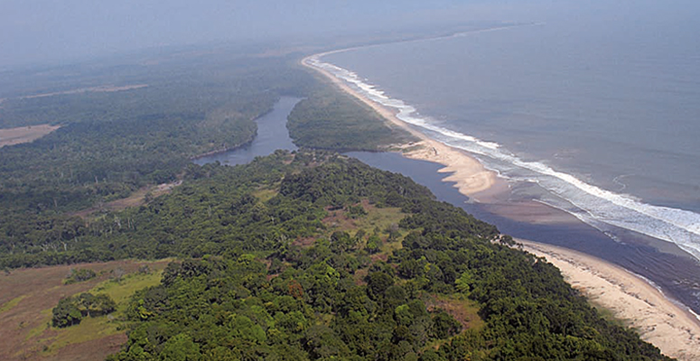
Congo, or Republic of Congo-Brazzaville, is a country of Africa, straddling the equator. It is surrounded by Gabon, Cameroon, the Central African Republic, the Democratic Republic of Congo (which the Congo River and the Ubangi river partly separate from Congo) and Cabinda, in Angola.

Congo extends on 1,300 km from North to South, from the Atlantic Ocean to the Central African border along the Congo River. It has many resources (water, woods, and ores) which are, unfortunately, badly exploited due to the sparse population.

Congo is sometimes called Congo-Brazzaville to avoid any confusion with the Democratic Republic of Congo or Congo-Kinshasa. Congo was also known as the Popular Republic of Congo (1969-1992).

1. Geographical overview

Bordered by the Atlantic Ocean, on a 170 km long frontage crossed by Ecuador, Congo is located in the heart of the African continent, in Central Africa.

The country stretches over 342,000 square kilometers, limiting Cameroon and Central Africa to the north, Angola and the Democratic Republic of Congo to the south and east, Gabon and the Atlantic coast to the west.

Congo, a transit country, is the ideal hub for goods destined for other countries of Central Africa, such as Cameroon, Chad, Central Africa, and even the Democratic Congo.

Watered frequently and abundantly by tropical rains, Congo is one of many powerful rivers. In addition to the Congo River – the largest in the world after the Amazon – there are more than thirty other rivers and rivers such as Kouilou, Niari, Bouenza, Alima, Sangha, Liouala. Mossaka and Ngoko watering the whole country. This makes this country one of the most fertile lands in Africa.

Of their fauna and flora, Congolese forests are among the richest in the world. There is a diversity of rare and highly sought after species (limba, okoumé, mahogany, sapelli, sipo …), as well as endangered animal species in the world such as gorilla, zebra and many others. .

This biodiversity makes the Congo Basin the largest lung of oxygen in the world after the Amazon.

Climate

The climate in Congo

Located on both sides of the equator, the Congo knows over almost all its extent, an equatorial rainfall pattern: maximum temperatures and rainfall interspersed with dry seasons at milder temperatures.

Over a year, the types of seasons that prevail in Congo are:

The great rainy season from October to December; high temperatures ranging from 25 ° to 35 ° with frequent rainfall.

  • The short dry season of January and February; no rain but high temperatures.
  • The short rainy season of March and April; high temperatures and frequent rain
  • The long dry season from May 15th to September 15th; no rain and much lower temperatures.
  • The north of the country is influenced by Ecuador with a stronger and more regular rainfall. Temperatures in the rainy season are significantly higher than in the South (from 5 ° to 10 °).

Demography

Congo Brazzaville Demographic

According to the latest results of the third general census of population and housing in 1996, the Congo has about 2,846,279 inhabitants spread over 342,000 square kilometers, an average density of 7.6 inhabitants per square kilometer.

The Congolese population is increasing quite rapidly. The average annual growth rate of 2.68% would lead to a doubling in 26 years. With around 60% of its population living in cities, Congo is one of the most urbanized countries in Africa. Brazzaville, the political capital – 950,000 inhabitants, Pointe-Noire, the economic capital – 500,000 inhabitants, alone concentrate about 55% of the total population and 90% of the urban population.

Congo’s population is young – over 50% is under 20 years old. This country has a high literacy rate (83%).

One of the demographic characteristics of the Congo is the presence of the Pygmies of Central Africa or indigenous peoples of the forests of Central Africa. They are found in the following departments: Lekoumou, Niari, Bouenza, Pool, Trays, West Bowl, Sangha and Likouala. These ancient peoples in the sub-region of Central Africa are recognized by their very old and very frugal natural way of life. They are scattered in the Central African Republic, Democratic Congo, Gabon and Cameroon. They have a great knowledge of their environment and live almost exclusively hunting, gathering and gathering.

Administrative organization

Administrative organization

Since the constitution of 20 January 2002, the Congolese territory has been divided into 11 departments, subdivided into 76 sub-prefectures and 7 urban communes.

These departments are, from north to south with their chief place:

  • Likouala (Impfondo),
  • Sangha (Ouesso),
  • Cuvette Ouest (Ewo),
  • Cuvette (Owando),
  • Plateaux (Djambala),
  • Pool (Kinkala),
  • Bouenza (Madingou),
  • Lékoumou (Sibiti),
  • Niari (Dolisie),
  • Kouilou (Pointe-Noire),
  • Brazzaville.

The urban communes are:

  • Brazzaville, political capital
  • Pointe-Noire, economic capital
  • Dolisie
  • Nkayi
  • Ouesso
  • Mossendjo
  • Owando.

Political organization

Political organization.

The Congo, now governed by the constitution of 20 January 2002, is a republic with a secular state.

This constitution guarantees the freedom of creation of political parties and enshrines the existence of three (3) distinct powers:

  • Executive power, embodied by the President of the Republic;
  • Legislative power represented by a bicameral parliament (Assembly and Senate);
  • Judiciary power.

The railway network

The railway network

An important asset is offered to economic operators: the railway, 510 km long, linking Brazzaville the political capital and Pointe-Noire the economic capital. This axis is completed by the perpendicular axis connecting Mont-Belo to Mbinda.